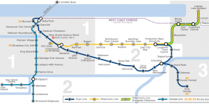
In the project, we will be mapping population within a census tract and using land use classification to determine constraints for developing Skytrain station. We want to minimize the walking distance between residential areas and areas without access to transportation to our proposed Skytrain station. We discovered some great results to highlight locations that are ideal for proposed Skytrain stations, and we took into account for the time/distance gap between each station to make a route that is the most efficient as possible.
The full project is available at: https://blogs.ubc.ca/mikiyinportfolio/the-planning-of-translink-stations-to-ubc/

Learning Significance