Discover Land Use Changes Over time and Analyze Urbanization Prepared for the Municipalities of Edmonton to Suggest Ecological Impacts.
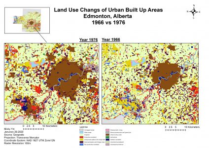
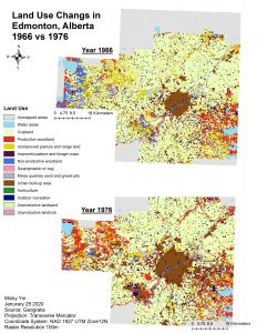
Executive Summary: This report drafts the land use changes of Edmonton city of Alberta in 1966 and 1976. The work is done through GIS and provides an analysis on their land use comparison. The changes of Edmonton city from 1966 to 1976 signify a period of urbanization and would need to a deeper insight on how much of other land uses are converted into urbanized architecture provided using a Transition Matrix Table. On the other hand, the population of Edmonton increased by approximately 80,329, showing an increase of 21% from 1966. It is a significant trigger to the development of land expansion of urban built-up areas. What are the impacts from 1966 to 1976 development when looking at Edge effects, and number of patches? As a result, Urban built areas in Edmonton have increased by 180% with nearly three times the size from 1966 with the large contributions using Cropland’s area. The influence on other land usage such productive wood should be considered in the future because they reduce flood risk. Therefore, the analysis section will provide indicators to account for indices such increased land space, resources, and the impact on ecosystem services such as Productive Woodland as well other ecological aspects of landscapes.